Close
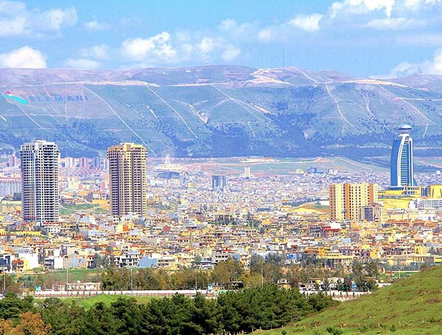
Baghdad is the administrative and political capital of the Republic of Iraq and the center of the Baghdad Governorate. Its total area is about 900 square kilometers, and its population reached about 7.6 million people in 2013.
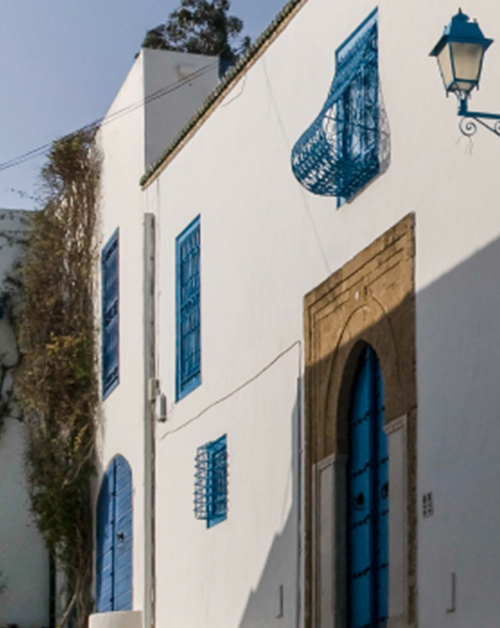
Baghdad is renowned for its vibrant culture and cultural heritage. This is manifest by landmark cultural buildings such as its museums, historical schools, libraries, and theaters. The city is famous for its Islamic monuments, which are represented by the remains of the ancient wall of Baghdad city, the house of the Caliphate, and the Mustansiriya School. Ancient Baghdad was known by several names such as the Round City (Al Madinah Al Modawara), Al-Zuwarah, and Dar Al-Salam. Al-Mansour, Al-Karadah, Al-Kadhimiya, Al-Adhammiya, and Sadr City are among the most prominent residential areas in Baghdad.
Baghdad has known a rapid rate of urban sprawl. This is largely due to a high demand for housing. In fact, high rates of population growth, migration from other governorates to the capital, and the rise in residential real-estate within have pushed people to seek housing on the outskirts of the city. This has materialized into a haphazard urbanization, the development of suburban neighborhoods, and a decline of agricultural lands located on the outskirts of the city.
Urban sprawl directly affects the level of public services that the State can provide to the city’s residents. This concerns key urban infrastructure services such as water, sewage, electricity and roads, and leads to a decrease in their quality within the city. To deal with these challenges, the city has taken several measures to ensure the provision of basic services to these new urban areas. This includes the rapid development of infrastructures into these areas, the establishment of planning regulations for the growing neighborhoods and dealing with the informal settlements within them.
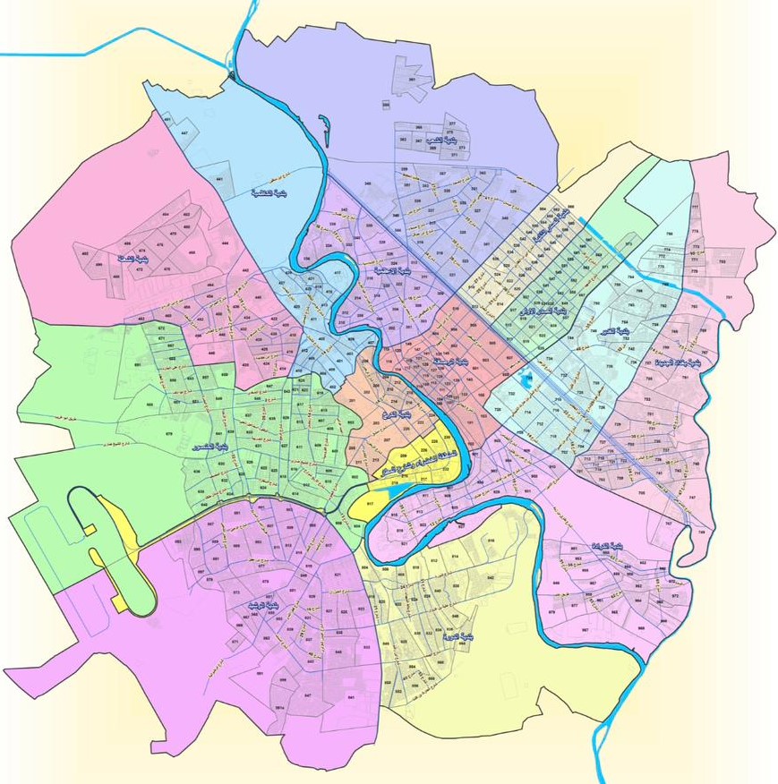
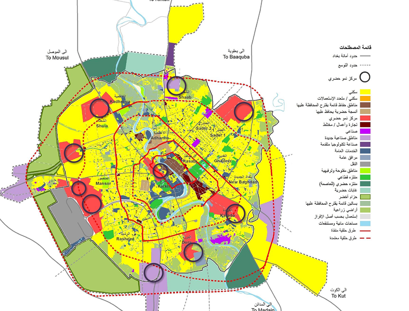
Title: Map shows the administrative boundary of the city
Source: Mayoralty of Baghdad
The population growth in Baghdad over the last ten years is estimated to be around 3.2-3.5% annually. It is expected that the city’s population will reach around 11.5 million people in 2030. The percentages of males and females out of the total city population are around 51% females and 49% males. The population pyramid is characterized as a regular population pyramid, where the proportion of younger age groups is higher than the middle and older age groups.
As for the distribution of the population according to income, most of the population is of middle income (around 50%), while the percentage of low income is around 20% and higher income around 30%.
Citizens constitute 99% of residents. As for the most prominent nationalities of non-citizen residents, they are mostly from East Asia (Bangladesh, Pakistan, Philippines) and they are spread throughout the city and are not concentrated in specific neighborhoods.
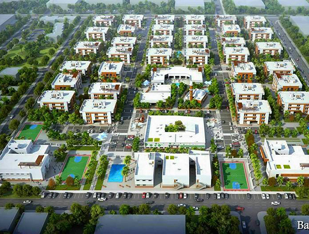
Housing demand represents a challenge for the city and its development. In dealing with this challenge, the approach has been to encourage housing projects in the vacant areas lots within central areas, and allow higher residential buildings to increase density. In addition, the city perimeter is enlarged and there are projects for new cities on the outskirts of the city to help absorb the housing needs.
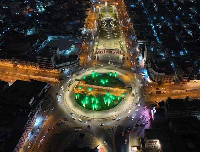
Title: Tahrir Square at night.
Source: The General Directorate of Relations and Media, Mayoralty of Baghdad.
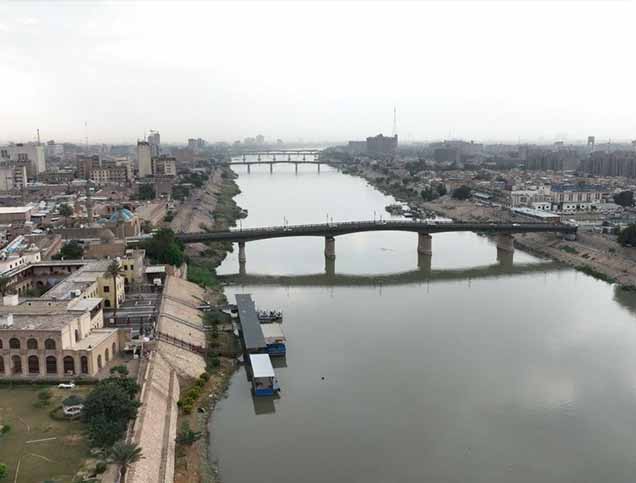
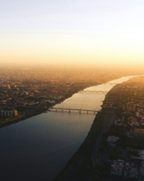
Title: Degla River.
Source: The General Directorate of Relations and Media, Mayoralty of Baghdad.
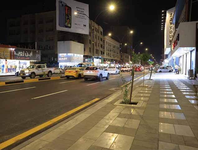
Title: Entrance to Karrada Street.
Source: The General Directorate of Relations and Media, Mayoralty of Baghdad.
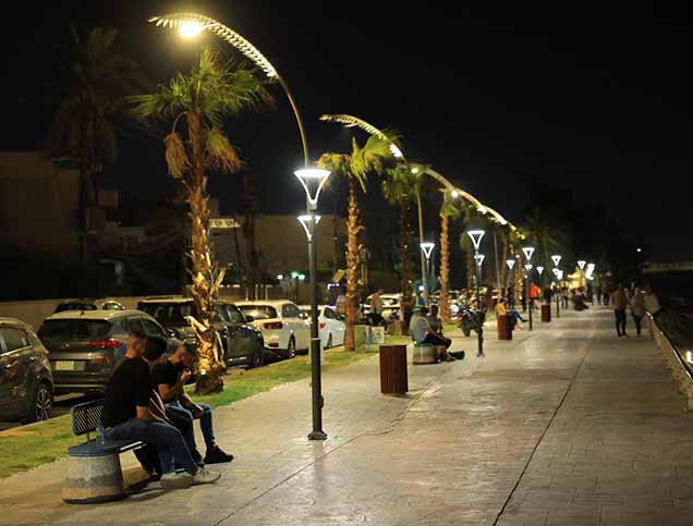
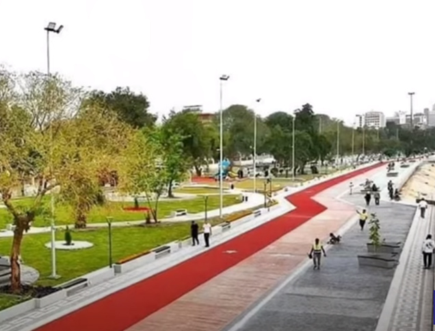
Title: Abu Nawas Corniche.
Source: The General Directorate of Relations and Media, Mayoralty of Baghdad.
Title: Tahrir Square at night.
Source: The General Directorate of Relations and Media, Mayoralty of Baghdad.
Title: Degla River.
Source: The General Directorate of Relations and Media, Mayoralty of Baghdad.
Title: Entrance to Karrada Street.
Source: The General Directorate of Relations and Media, Mayoralty of Baghdad.
Title: Abu Nawas Corniche.
Source: The General Directorate of Relations and Media, Mayoralty of Baghdad.
The nature of the climate in Baghdad is hot and dry in the summer, and cold and rainy in the winter. The average summer temperature is around 45°C and in winter around 5°C, with an average rainfall of 60 mm annually.
The distribution of water resources across different sectors in the governorate is as follows: 50% drinking water, 20% agriculture, 10% industry, 10% tourism. The most prominent green spaces in the city are: Al-Zawraa Park, the Tourist City, and orchards along the Degla River, and these account for about 5% of the city’s area. Agricultural activity in the city does not exceed 5% of the city’s area.
The most prominent environmental challenges in Baghdad Governorate are: pollution resulting from factories (oil refineries) and plants, in addition to heat emissions from power generation stations, and gases emitted from the exhaust of the many vehicles in the city. There is also pollution of the city’s water due to inefficiencies in wastewater treatment. Additionally, there is a decrease in the percentage of vegetation cover in the city due to encroachments on agricultural lands and others.
Various entities have conducted studies to understand the city’s environmental situation and propose solutions; however, projects implemented in this regard are still limited so far.
The workforce is distributed across economic sectors as follows: 70% public sector, and the remaining between the private sector and unemployment. The unemployment rate here is around 25% of the workforce. The poverty rate is around 20%.
The unstable security situation that persisted for a long time, the decline of the State’s role, and particularly its lack of support to the industrial sectors in the city under these circumstances, and the fluctuations in the exchange rate of the local currency against the dollar, have had an impact on the decline of entrepreneurship and investment in Baghdad and lead to an increase in unemployment and “disguised” unemployment there.
The types of housing tenure in the city are diverse and distributed as follows: 70% owner-occupied housing, 10% rented housing, while 20% fall under the category of illegal slums/ informal settlements. As for the percentage of vacant housing (vacancy rates), it is around 3-5% of the total housing units in the city.
The main housing challenges are the lack of lands for affordable housing in the city central areas, and various types of encroachments and violations to the building and urban planning codes (such as informal construction on agricultural lands, building violations, and the informal subdivision of residential units). In addition to that, there is the high cost of residential units compared to the average income, amid increasing demand for housing and limited government support for the housing sector (e.g. limited affordable housing loans offer).
As for the most prominent existing or proposed plans and projects to address these challenges, they include: establishing new cities, expanding municipal boundaries, increasing the density of residential areas by changing the land use to encourage higher buildings, and seeking to increase capital and allocations for housing loans.
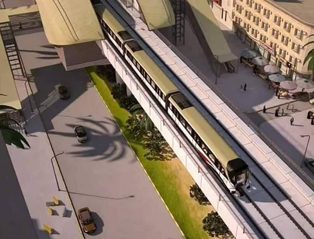
The most prominent transportation infrastructure in the city are highways, including the Muhammad Al-Qasim and Army Canal highways, Airport Road, Euphrates Street, and Atabat Ibn Ghazwan Street. As for the total length of the road network in the city, it is about 300 kilometers.
The modes of transportation are distributed as follows: the majority are private cars, constituting around 50% of total trips. As for public transportation (buses), it constitutes about 10%, motorcycles are close to 5%, while taxis account for 3%. The percentage of walking and bicycle use for daily trips remains generally marginal.
There are around 20 large garages – where taxis and buses linking the Baghdad to other cities and regions usually park – distributed around the city. As for the number of taxis, it is around 30-35% of the total number of vehicles, which is approximately 4 million vehicles.
The main challenges facing the city in terms of mobility and transportation are as follows:
– The increase in the number of private cars, and haphazard driving due to lack of compliance with driving safety regulations.
– Limited possibilities to go from one to the other suburbs without going through the central areas, leading to a heavy traffic in downtown neighborhoods.
– Recurring maintenance issues on some main streets, causing significant traffic congestion.
As for the most prominent existing or proposed projects to address these challenges, they include projects to implement a ring road around the city and projects to convert some intersections by constructing bridges, in addition to rehabilitating and maintaining some existing highways and bridges.
An online library where you can explore relevant data on urban development in the Arab cities.
More


Lorem ipsum dolor sit amet consectetur. Lacus nibh neque erat massa elementum. Ultricies ante sed sed nunc massa ider.
Last updated 3 mins ago
Lorem ipsum dolor sit amet consectetur. Lacus nibh neque erat massa elementum. Ultricies ante sed sed nunc massa ider.
Last updated 3 mins ago
Lorem ipsum dolor sit amet consectetur. Lacus nibh neque erat massa elementum. Ultricies ante sed sed nunc massa ider.
Last updated 3 mins ago
Lorem ipsum dolor sit amet consectetur. Lacus nibh neque erat massa elementum. Ultricies ante sed sed nunc massa ider.
Last updated 3 mins ago
Lorem ipsum dolor sit amet consectetur. Lacus nibh neque erat massa elementum. Ultricies ante sed sed nunc massa ider.
Last updated 3 mins ago
Lorem ipsum dolor sit amet consectetur. Lacus nibh neque erat massa elementum. Ultricies ante sed sed nunc massa ider.
Last updated 3 mins ago